

注册成为位构云的开发者:
第一步,注册位构云平台账号
第二步,控制台创建地图项目
第三步,获取Key
<!DOCTYPE html>
<html lang="en">

<head>
  <title>基础地图</title>
  <meta http-equiv="Content-Type" content="text/html; charset=utf-8" />
  <meta name="viewport" content="width=device-width,initial-scale=1.0" />
  <script src="https://www.wxb3d.com/saas/sdk/v1/VgoMap.umd.js"></script>
  <link rel="stylesheet" href="https://www.wxb3d.com/saas/sdk/v1/VgoMap.umd.css">
</head>
<style>
  html,
  body {
    width: 100%;
    height: 100%;
    padding: 0px;
    margin: 0px;
    box-sizing: border-box;
  }
</style>

<body>
  <div id="mapContainer" style="width: 100%; height: 100%;"></div>
</body>
<script>
  let mapId = '1633665850273828864' // 您创建的地图ID

  // 初始化地图
  let map = new VgoMap.Map({
    el: 'mapContainer',
    id: mapId,
  })

  // 监听地图加载完成
  map.on('loaded', () => {
    console.log('地图加载成功')
  })
</script>

</html>

<!DOCTYPE html>
<html lang="en">

<head>
  <title>模式切换</title>
  <meta http-equiv="Content-Type" content="text/html; charset=utf-8" />
  <meta name="viewport" content="width=device-width,initial-scale=1.0" />
  <script src="https://www.wxb3d.com/saas/sdk/v1/VgoMap.umd.js"></script>
  <link rel="stylesheet" href="https://www.wxb3d.com/saas/sdk/v1/VgoMap.umd.css">
</head>
<style>
  html,
  body {
    width: 100%;
    height: 100%;
    padding: 0px;
    margin: 0px;
    box-sizing: border-box;
    position: relative;
  }

  .card {
    position: absolute;
    bottom: 50px;
    left: 50%;
    transform: translateX(-50%);
    box-shadow: 0px 0px 3px 3px rgba(0, 0, 0, 0.07);
    z-index: 1;
    padding: 10px;
    border-radius: 10px;
    font-size: 12px;
    background-color: #fff;
  }
</style>

<body>
  <div id="mapContainer" style="width: 100%; height: 100%;"></div>
  <div class="card">
    移动地图并缩放,将自动切换室内外模式
  </div>
</body>
<script>
  let mapId = '1661676290278822678' // 您创建的地图ID

  // 初始化地图
  let map = new VgoMap.Map({
    el: 'mapContainer',
    id: mapId,
  })

  map.on('loaded', () => {
    console.log('地图加载成功')
  })
</script>

</html>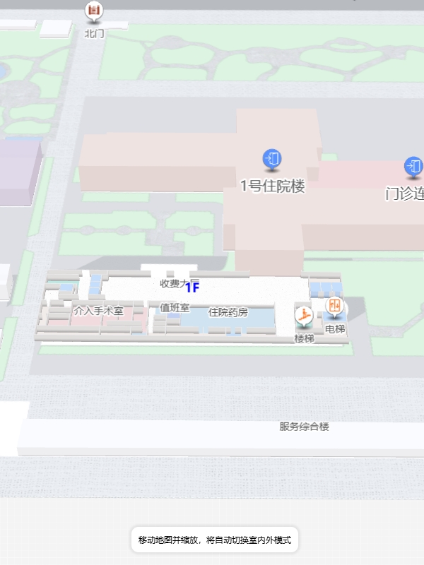
<!DOCTYPE html>
<html lang="en">
<head>
<title>楼层控件</title>
<meta http-equiv="Content-Type" content="text/html; charset=utf-8" />
<meta name="viewport" content="width=device-width,initial-scale=1.0" />
<script src="https://www.wxb3d.com/saas/sdk/v1/VgoMap.umd.js"></script>
<link rel="stylesheet" href="https://www.wxb3d.com/saas/sdk/v1/VgoMap.umd.css">
</head>
<style>
html,
body {
width: 100%;
height: 100%;
padding: 0px;
margin: 0px;
box-sizing: border-box;
}
.card {
position: absolute;
bottom: 50px;
left: 50%;
transform: translateX(-50%);
box-shadow: 0px 0px 3px 3px rgba(0, 0, 0, 0.07);
z-index: 1;
padding: 10px;
border-radius: 10px;
font-size: 12px;
background-color: #fff;
}
</style>
<body>
<div id="mapContainer" style="width: 100%; height: 100%;"></div>
</body>
<script>
let mapId = '1650704053455425536' // 您创建的地图ID
// 初始化地图
let map = new VgoMap.Map({
el: 'mapContainer',
id: mapId,
})
// 监听地图加载完成
map.on('loaded', () => {
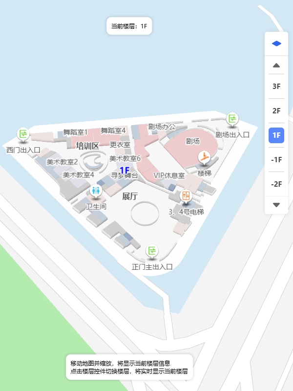
let floorControl = new VgoMap.FloorControl({
map,
style: 'inset: 80px 20px auto auto;',
floorButtonCount: 5, // 楼层显示按钮数量
showAllFloorButton: true, // 是否显示多层展示按钮
})
})
</script>
</html>
<!DOCTYPE html>
<html lang="en">
<head>
<title>地图移动</title>
<meta http-equiv="Content-Type" content="text/html; charset=utf-8" />
<meta name="viewport" content="width=device-width,initial-scale=1.0" />
<script src="https://www.wxb3d.com/saas/sdk/v1/VgoMap.umd.js"></script>
<link rel="stylesheet" href="https://www.wxb3d.com/saas/sdk/v1/VgoMap.umd.css">
</head>
<style>
html,
body {
width: 100%;
height: 100%;
padding: 0px;
margin: 0px;
box-sizing: border-box;
}
.card {
position: absolute;
bottom: 50px;
left: 50%;
transform: translateX(-50%);
box-shadow: 0px 0px 3px 3px rgba(0, 0, 0, 0.07);
z-index: 1;
padding: 10px;
border-radius: 10px;
font-size: 12px;
background-color: #fff;
}
</style>
<body>
<div id="mapContainer" style="width: 100%; height: 100%;"></div>
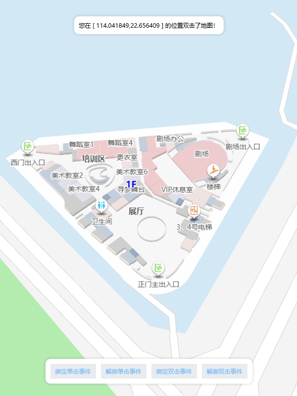
<div class="card">
双击地图,移动到相关位置
</div>
</body>
<script>
let mapId = '1633665850273828864' // 您创建的地图ID
// 初始化地图
let map = new VgoMap.Map({
el: 'mapContainer',
id: mapId,
})
// 监听地图加载完成
map.on('loaded', () => {
console.log('地图加载成功')
// 绑定地图双击事件
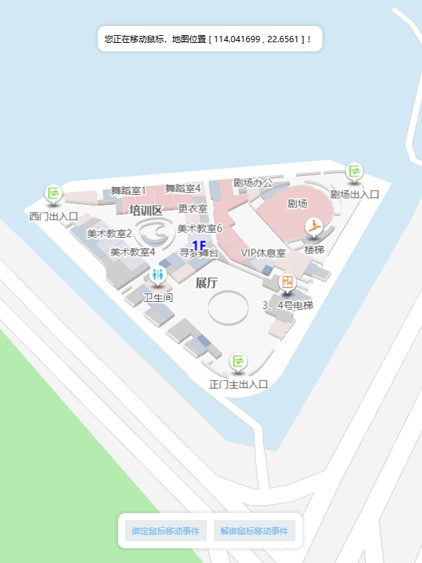
map.amap.on('dblclick', (e) => {
const { lnglat } = e
// 设置地图移动
map.amap.panTo(lnglat)
})
})
</script>
</html>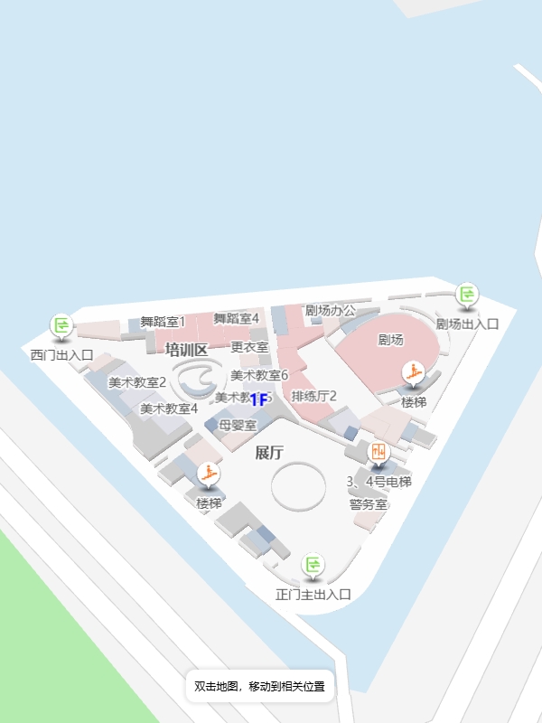
<!DOCTYPE html>
<html lang="en">

<head>
  <title>地图加载成功事件</title>
  <meta http-equiv="Content-Type" content="text/html; charset=utf-8" />
  <meta name="viewport" content="width=device-width,initial-scale=1.0" />
  <script src="https://www.wxb3d.com/saas/sdk/v1/VgoMap.umd.js"></script>
  <link rel="stylesheet" href="https://www.wxb3d.com/saas/sdk/v1/VgoMap.umd.css">
</head>
<style>
  html,
  body {
    width: 100%;
    height: 100%;
    padding: 0px;
    margin: 0px;
    box-sizing: border-box;
  }
</style>

<body>
  <div id="mapContainer" style="width: 100%; height: 100%;"></div>
</body>
<script>
  let mapId = '1633665850273828864' // 您创建的地图ID

  // 初始化地图
  let map = new VgoMap.Map({
    el: 'mapContainer',
    id: mapId,
  })

  // 监听地图加载完成
  map.on('loaded', () => {
    // 我们推荐您所有基于地图的操作都在地图加载完成后处理
    console.log('地图加载成功')
  })
</script>

</html>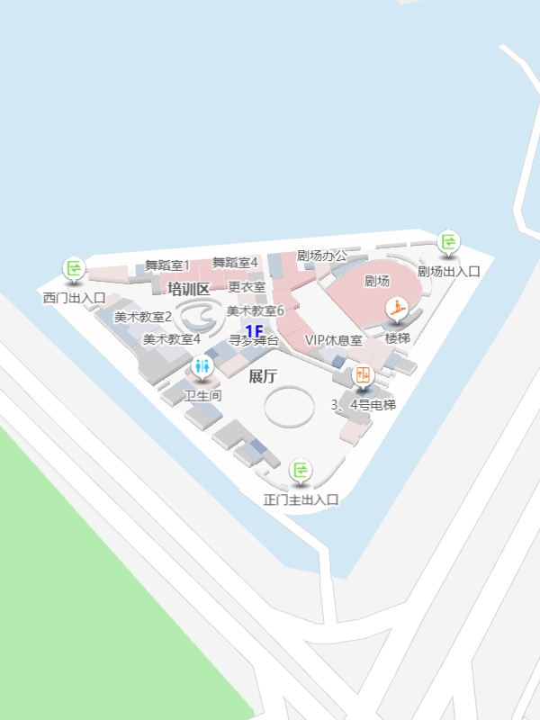
<!DOCTYPE html>
<html lang="en">
<head>
<title>图片覆盖物</title>
<meta http-equiv="Content-Type" content="text/html; charset=utf-8" />
<meta name="viewport" content="width=device-width,initial-scale=1.0" />
<script src="https://www.wxb3d.com/saas/sdk/v1/VgoMap.umd.js"></script>
<link rel="stylesheet" href="https://www.wxb3d.com/saas/sdk/v1/VgoMap.umd.css">
</head>
<style>
html,
body {
width: 100%;
height: 100%;
padding: 0px;
margin: 0px;
box-sizing: border-box;
font-size: 15px;
}
p {
margin: 0px;
padding: 0px;
}
.card {
position: absolute;
bottom: 50px;
left: 50%;
transform: translateX(-50%);
box-shadow: 0px 0px 3px 3px rgba(0, 0, 0, 0.07);
z-index: 1;
padding: 10px;
border-radius: 10px;
font-size: 12px;
background-color: #fff;
}
.typeBtn {
padding: 0px 10px;
height: 30px;
display: flex;
align-items: center;
justify-content: center;
background-color: #e9ecef;
color: #74b9ff;
white-space: nowrap;
cursor: pointer;
user-select: none;
margin-right: 10px;
margin-top: 10px;
}
</style>
<body>
<div id="mapContainer" style="width: 100%; height: 100%;"></div>
<div class="card">
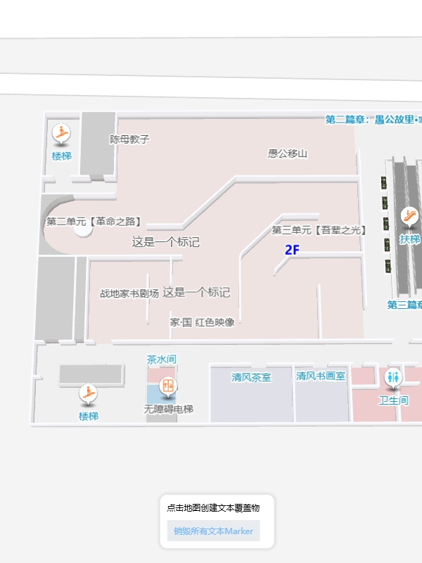
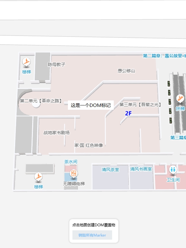
<p>点击地图创建图片覆盖物</p>
<div class="typeBtn" onclick="destroy()">销毁所有Marker</div>
</div>
</body>
<script>
let mapId = '1650704053455425536' // 您创建的地图ID
let marker = null
// 初始化地图
let map = new VgoMap.Map({
el: 'mapContainer',
id: mapId,
})
// 监听地图加载完成
map.on('loaded', () => {
// 监听地图点击事件
map.on('click', (e) => {
console.log(e, 'e')
// 将经纬度转换成坐标
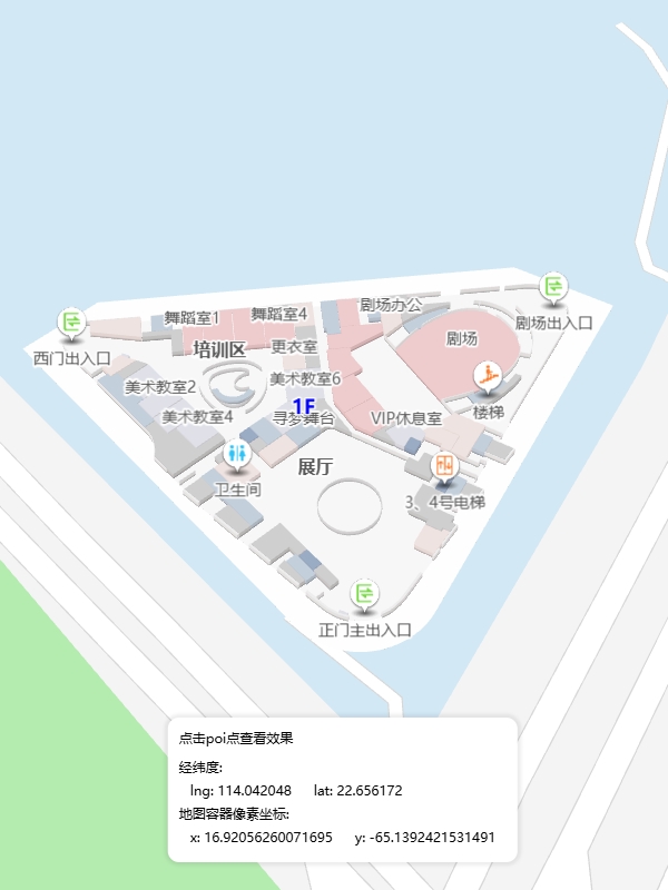
let coords = map.lngLatToCoord(e.lnglat)
// 获取poi点数据
const polygon = e.object?.userData?.polygonData
console.log(coords, 'coords')
/**
* addCustomMarker(floorId, ops)
* floorId 楼层ID 用于设置当前 Marker 在那层显示
* **/
if (polygon?.parent?.id) {
marker = map.addCustomMarker(polygon.parent.id, {
isCollision: false, // 是否有碰撞体积
position: coords,
scale: 0.15, // 缩放
src: 'https://vgo-1258766855.cos.ap-nanjing.myqcloud.com/saas/general/8011b647-303c-4858-b12d-91b8c9268635.png',
})
}
})
})
function destroy () {
// 销毁所有 marker
marker && map.removeAllCustomMarker()
marker = null
}
</script>
</html>
<!DOCTYPE html>
<html lang="en">

<head>
  <title>搜索查询</title>
  <meta http-equiv="Content-Type" content="text/html; charset=utf-8" />
  <meta name="viewport" content="width=device-width,initial-scale=1.0" />
  <script src="https://www.wxb3d.com/saas/sdk/v1/VgoMap.umd.js"></script>
  <link rel="stylesheet" href="https://www.wxb3d.com/saas/sdk/v1/VgoMap.umd.css">
</head>
<style>
  html,
  body {
    width: 100%;
    height: 100%;
    padding: 0px;
    margin: 0px;
    box-sizing: border-box;
    position: relative;
  }

  .card {
    display: none;
    max-width: 500px;
    position: absolute;
    bottom: 50px;
    left: 50%;
    transform: translateX(-50%);
    box-shadow: 0px 0px 3px 3px rgba(0, 0, 0, 0.07);
    z-index: 1;
    padding: 10px;
    border-radius: 10px;
    font-size: 12px;
    background-color: #fff;
  }

  .label {
    margin-top: 5px;
  }

  .input-item {
    position: relative;
    display: flex;
    flex-wrap: wrap;
    align-items: center;
    margin-top: 5px;
    flex-wrap: nowrap;
  }

  .input-item-prepend {
    margin-right: -1px;
  }

  .input-item-text {
    width: 40px;
    height: 28px;
    display: flex;
    align-items: center;
    justify-content: center;
    white-space: nowrap;
    background-color: #e9ecef;
    border: 1px solid #ced4da;
    border-radius: 0.25rem;
    border-bottom-right-radius: 0;
    border-top-right-radius: 0;
  }

  input {
    height: 26px;
    margin: 0;
    font-family: inherit;
    font-size: inherit;
    line-height: inherit;
    overflow: visible;
    text-transform: none;
    border: 1px solid #ced4da;
    background-color: #fff;
  }

  input:focus {
    outline: 0px;
    border: 1px solid #74b9ff;
  }

  .typeBtn {
    padding: 0px 10px;
    height: 30px;
    display: flex;
    align-items: center;
    justify-content: center;
    background-color: #e9ecef;
    color: #74b9ff;
    white-space: nowrap;
    cursor: pointer;
  }

  .content {
    margin-top: 10px;
  }

  .list {
    max-height: 160px;
    overflow: auto;
  }

  .list span {
    margin: 3px 5px;
    white-space: nowrap;
  }
</style>

<body>
  <div id="mapContainer" style="width: 100%; height: 100%;"></div>
  <div class="card">
    <div class="label" style='color:grey'>按ID查询</div>
    <div class="input-item">
      <div class="input-item-prepend">
        <span class="input-item-text">ID</span>
      </div>
      <input id='byID' type="text" value="">
      <div class="typeBtn" onclick="query('#byID')">查询</div>
    </div>

    <div class="label" style='color:grey'>按名称查询</div>
    <div class="input-item">
      <div class="input-item-prepend">
        <span class="input-item-text">名称</span>
      </div>
      <input id='byName' type="text" value="">
      <div class="typeBtn" onclick="query('#byName')">查询</div>
    </div>


    <div class="content">
      <div class="tip">搜索结果:</div>
      <div class="list">

      </div>
    </div>
  </div>
</body>
<script>
  let mapId = '1633665850273828864' // 您创建的地图ID
  let card = document.querySelector('.card')

  function query (el) {
    let val = document.querySelector(el).value
    let listDom = document.querySelector('.list')

    if (!val) { return false }

    listDom.innerHTML = null
    if (el === '#byID') {
      // 按ID查询
      let poi = map.getPolygonDataById(val)


      let span = document.createElement('span')
      span.innerText = poi.name

      listDom.appendChild(span)
    } else {
      // 按名称查询
      let list = map.getAreaByName(val)


      list.map(item => {
        let span = document.createElement('span')
        span.innerText = item.name

        listDom.appendChild(span)
      })
    }
  }

  // 初始化地图
  let map = new VgoMap.Map({
    el: 'mapContainer',
    id: mapId,
  })

  map.on('loaded', () => {
    console.log('地图加载成功')
    card.style.display = 'block'
  })
</script>

</html>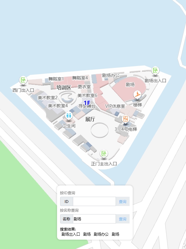
<!DOCTYPE html>
<html lang="en">
<head>
<title>路线规划</title>
<meta http-equiv="Content-Type" content="text/html; charset=utf-8" />
<meta name="viewport" content="width=device-width,initial-scale=1.0" />
<script src="https://www.wxb3d.com/saas/sdk/v1/VgoMap.umd.js"></script>
<link rel="stylesheet" href="https://www.wxb3d.com/saas/sdk/v1/VgoMap.umd.css">
</head>
<style>
html,
body {
width: 100%;
height: 100%;
padding: 0px;
margin: 0px;
box-sizing: border-box;
font-size: 15px;
}
p {
margin: 0px;
padding: 0px;
}
.card {
position: absolute;
bottom: 50px;
left: 50%;
transform: translateX(-50%);
box-shadow: 0px 0px 3px 3px rgba(0, 0, 0, 0.07);
z-index: 1;
padding: 10px;
border-radius: 10px;
font-size: 12px;
background-color: #fff;
}
.typeBtn {
padding: 0px 10px;
height: 30px;
display: flex;
align-items: center;
justify-content: center;
background-color: #e9ecef;
color: #74b9ff;
white-space: nowrap;
cursor: pointer;
user-select: none;
margin-right: 10px;
margin-top: 10px;
}
.input-card {
background-color: #fff;
border-radius: 5px;
box-shadow: 3px 3px 5px 3px rgba(0, 0, 0, 0.07);
transform: translateY(-25px);
}
.input-card .name {
font-size: 15px;
background-color: #50b4b9;
color: #fff;
padding: 5px 10px;
}
.input-card::after {
content: '';
width: 15px;
height: 15px;
position: absolute;
bottom: 0px;
left: 50%;
transform: translateX(-50%) translateY(50%) rotateZ(45deg);
background-color: #fff;
}
.bar {
display: flex;
flex-wrap: nowrap;
background-color: #fff;
}
.btn {
margin: 12px 7px;
padding: 5px 10px;
background-color: #f3f3f3;
font-size: 14px;
color: #4C4E4E;
white-space: nowrap;
}
#tip {
display: none;
position: absolute;
top: 50px;
left: 50%;
transform: translateX(-50%);
box-shadow: 0px 0px 3px 3px rgba(0, 0, 0, 0.07);
z-index: 1;
padding: 10px;
border-radius: 10px;
font-size: 12px;
background-color: #fff;
}
</style>
<body>
<div id="mapContainer" style="width: 100%; height: 100%;"></div>
<div id="tip">
</div>
<div class="card">
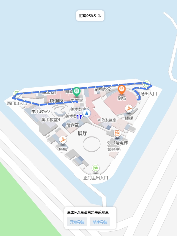
<p>点击POI点设置起点或终点</p>
<div class="typeBtn" onclick="destroy('line')">销毁路线</div>
<div class="typeBtn" onclick="destroy('start')">销毁起点</div>
<div class="typeBtn" onclick="destroy('end')">销毁终点</div>
</div>
</body>
<script>
let mapId = '1633665850273828864' // 您创建的地图ID
let tip = document.querySelector('#tip')
let polygon, start, end
// 初始化地图
let map = new VgoMap.Map({
el: 'mapContainer',
id: mapId,
})
//在指定位置打开信息窗体
function openInfo (lnglat, name) {
//构建信息窗体中显示的内容
var info = `
<div class='input-card content-window-card'>
<div class="name">${name}</div>
<div class="bar">
<div class="btn start" onclick="setStart()">设为起点</div>
<div class="btn end" onclick="setEnd()">设为终点</div>
</div>
</div>
`
infoWindow = new AMap.InfoWindow({
content: info, //使用默认信息窗体框样式,显示信息内容
isCustom: true, // 如果为true,则DOM所有样式需自己定义
});
infoWindow.open(map.amap, lnglat);
}
// 监听地图加载完成
map.on('loaded', () => {
// 监听地图点击事件
map.on('click', (e) => {
// 获取poi点数据
polygon = e.object?.userData?.polygonData || null
if (!polygon?.buildData && polygon?.name) {
let lngLat = map.coordsToLngLat(polygon.center)
openInfo(lngLat, polygon.name)
}
})
})
function findPath () {
map.amap.clearInfoWindow();
if (!start || !end) {
tip.style.display = 'none'
return false
}
// 设置了起点和终点后可进行路线规划
map.navi.find().then(() => {
// 路线规划成功,获取路线距离
let distance = map.navi.status.routeDistance.toFixed(2) || 0
tip.style.display = 'block'
tip.innerHTML = `距离:${distance}米`
}).catch(err => {
// 路线规划失败
console.log(err, 'err')
alert('未找到路线, 请联系地图制作方!')
})
}
function setStart () {
start = polygon
map.navi.setStart(polygon.id)
findPath()
}
function setEnd () {
end = polygon
map.navi.setEnd(end.id)
findPath()
}
function destroy (type) {
// 销毁自定义dommarker
map.amap.clearInfoWindow();
if (type === 'line') {
// 销毁路线
map.navi.removeNaviArrow()
// 销毁箭头
map.navi.removeNaviLine()
} else if (type === 'start') {
// 销毁起点
map.navi.removeStart()
start = null
} else {
//销毁终点
map.navi.removeEnd()
end = null
}
}
</script>
</html>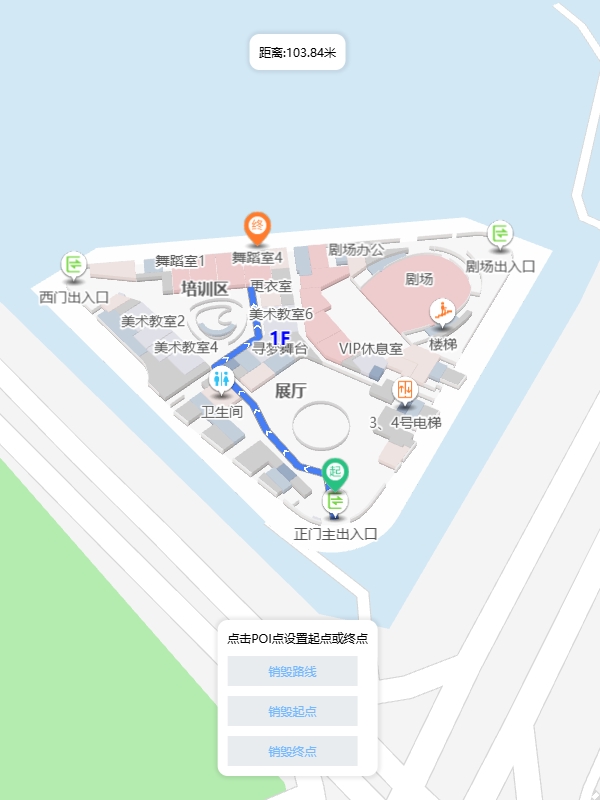
<!DOCTYPE html>
<html lang="en">

<head>
  <title>模拟导航</title>
  <meta http-equiv="Content-Type" content="text/html; charset=utf-8" />
  <meta name="viewport" content="width=device-width,initial-scale=1.0" />
  <script src="https://www.wxb3d.com/saas/sdk/v1/VgoMap.umd.js"></script>
  <link rel="stylesheet" href="https://www.wxb3d.com/saas/sdk/v1/VgoMap.umd.css">
</head>
<style>
  html,
  body {
    width: 100%;
    height: 100%;
    padding: 0px;
    margin: 0px;
    box-sizing: border-box;
    font-size: 15px;
  }

  p {
    margin: 0px;
    padding: 0px;
  }

  .card {
    position: absolute;
    bottom: 50px;
    left: 50%;
    transform: translateX(-50%);
    box-shadow: 0px 0px 3px 3px rgba(0, 0, 0, 0.07);
    z-index: 1;
    padding: 10px;
    border-radius: 10px;
    font-size: 12px;
    background-color: #fff;
  }

  .list {
    display: flex;
  }

  .typeBtn {
    padding: 0px 10px;
    height: 30px;
    display: flex;
    align-items: center;
    justify-content: center;
    background-color: #e9ecef;
    color: #74b9ff;
    white-space: nowrap;
    cursor: pointer;
    user-select: none;
    margin-right: 10px;
  }

  .speed {
    background-color: #e9ecef;
    color: #57606f;
    cursor: default;
  }

  .input-card {
    background-color: #fff;
    border-radius: 5px;
    box-shadow: 3px 3px 5px 3px rgba(0, 0, 0, 0.07);
    transform: translateY(-25px);
  }

  .input-card .name {
    font-size: 15px;
    background-color: #50b4b9;
    color: #fff;
    padding: 5px 10px;
  }

  .input-card::after {
    content: '';
    width: 15px;
    height: 15px;
    position: absolute;
    bottom: 0px;
    left: 50%;
    transform: translateX(-50%) translateY(50%) rotateZ(45deg);
    background-color: #fff;
  }

  .bar {
    display: flex;
    flex-wrap: nowrap;
    background-color: #fff;
  }

  .btn {
    margin: 12px 7px;
    padding: 5px 10px;
    background-color: #f3f3f3;
    font-size: 14px;
    color: #4C4E4E;
    white-space: nowrap;
  }

  #tip {
    display: none;
    position: absolute;
    top: 50px;
    left: 50%;
    transform: translateX(-50%);
    box-shadow: 0px 0px 3px 3px rgba(0, 0, 0, 0.07);
    z-index: 1;
    padding: 10px;
    border-radius: 10px;
    font-size: 12px;
    background-color: #fff;
  }
</style>

<body>
  <div id="mapContainer" style="width: 100%; height: 100%;"></div>
  <div id="tip">
  </div>
  <div class="card">
    <!-- <p>点击POI点设置起点或终点</p> -->
    <div class="list">
      <div class="typeBtn" onclick="startNavi()">开始导航</div>
      <div class="typeBtn" onclick="pauseNavi()">暂停</div>
      <div class="typeBtn" onclick="restoreNavi()">继续</div>
      <div class="typeBtn" onclick="stopNavi()">结束</div>
      <div class="typeBtn" onclick="switchSpeed()">切换速度</div>
      <div class="typeBtn speed">
        低速
      </div>
    </div>
  </div>
</body>
<script>
  let mapId = '1633665850273828864' // 您创建的地图ID
  let tip = document.querySelector('#tip')
  let speedDom = document.querySelector('.speed')

  let polygon
  let start = {
    id: 'lf0td0xjb3'
  }
  let end = {
    id: 'lf0vl3w40p'
  }

  let speed = [
    { text: '低速', val: 2.5 },
    { text: '中速', val: 5 },
    { text: '高速', val: 10 },
  ]
  let seepIndex = 0

  // 初始化地图
  let map = new VgoMap.Map({
    el: 'mapContainer',
    id: mapId,
  })

  //在指定位置打开信息窗体
  function openInfo (lnglat, name) {
    var info = `
    <div class='input-card content-window-card'>
      <div class="name">${name}</div>
      <div class="bar">
        <div class="btn start" onclick="setStart()">设为起点</div>
        <div class="btn end" onclick="setEnd()">设为终点</div>
      </div>
    </div>
    `
    infoWindow = new AMap.InfoWindow({
      content: info,  //使用默认信息窗体框样式,显示信息内容
      isCustom: true, // 如果为true,则DOM所有样式需自己定义
    });

    infoWindow.open(map.amap, lnglat);
  }

  // 监听地图加载完成
  map.on('loaded', () => {
    // 监听地图点击事件
    map.on('click', (e) => {
      // 获取poi点数据
      polygon = e.object?.userData?.polygonData || null

      if (!polygon?.buildData && polygon?.name) {
        let lngLat = map.coordsToLngLat(polygon.center)
        openInfo(lngLat, polygon.name)
      }
    })

    // 设置默认起始点
    map.navi.setStart(start.id)
    map.navi.setEnd(end.id)
    map.navi.find().then(() => {
      // 路线规划成功,获取路线距离
      let distance = map.navi.status.routeDistance.toFixed(2) || 0
      tip.style.display = 'block'
      tip.innerHTML = `距离:${distance}米`
    })
  })

  function findPath () {
    map.amap.clearInfoWindow();

    if (!start || !end) {
      tip.style.display = 'none'
      return false
    }


    // 设置了起点和终点后可进行路线规划
    map.navi.find().then(() => {
      // 路线规划成功,获取路线距离
      let distance = map.navi.status.routeDistance.toFixed(2) || 0
      tip.style.display = 'block'
      tip.innerHTML = `距离:${distance}米`
    }).catch(err => {
      // 路线规划失败
      console.log(err, 'err')
      alert('未找到路线, 请联系地图制作方!')
    })
  }

  function setStart () {
    start = polygon
    map.navi.setStart(polygon.id)

    findPath()
  }

  function setEnd () {
    end = polygon
    map.navi.setEnd(end.id)

    findPath()
  }


  // 开始导航
  function startNavi () {
    if (!start || !end) return false

    map.navi.simulate()
    // 设置速度
    map.navi.setSimulateSpeed(speed[seepIndex].val)
  }

  // 暂停导航
  function pauseNavi () {
    // 判断当前是否处于导航中
    if (map.navi.status.isSimulate) {
      map.navi.pauseSimulate()
    }
  }

  //继续导航
  function restoreNavi () {
    // 判断当前是否处于暂停中
    if (!map.navi.isSimulatePause) {
      map.navi.resumeSimulate()
    }
  }


  // 退出导航
  function stopNavi () {
    // 退出模拟导航
    map.navi.stopSimulate()
    // 销毁箭头
    map.navi.removeNaviArrow()
    // 销毁线路
    map.navi.removeNaviLine()
    //移除终点
    map.navi.removeEnd()
    end = null
  }

  // 切换速度
  function switchSpeed () {
    seepIndex = seepIndex >= 2 ? 0 : ++seepIndex
    speedDom.innerHTML = speed[seepIndex].text

    // 设置速度
    map.navi.setSimulateSpeed(speed[seepIndex].val)
  }

</script>

</html>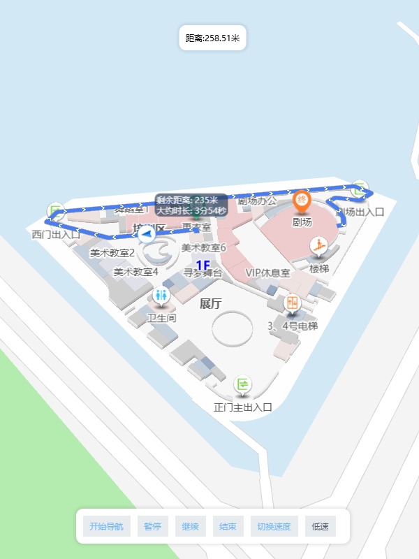
<!DOCTYPE html>
<html lang="en">

<head>
  <title>模型动画</title>
  <meta http-equiv="Content-Type" content="text/html; charset=utf-8" />
  <meta name="viewport" content="width=device-width,initial-scale=1.0" />
  <script src="https://www.wxb3d.com/saas/sdk/v1/VgoMap.umd.js"></script>
  <link rel="stylesheet" href="https://www.wxb3d.com/saas/sdk/v1/VgoMap.umd.css">
</head>
<style>
  html,
  body {
    width: 100%;
    height: 100%;
    padding: 0px;
    margin: 0px;
    box-sizing: border-box;
    font-size: 15px;
  }

  p {
    margin: 0px;
    padding: 0px;
  }

  .card {
    position: absolute;
    bottom: 50px;
    left: 50%;
    transform: translateX(-50%);
    box-shadow: 0px 0px 3px 3px rgba(0, 0, 0, 0.07);
    z-index: 1;
    padding: 10px;
    border-radius: 10px;
    font-size: 12px;
    background-color: #fff;
  }

  .typeBtn {
    padding: 0px 10px;
    height: 30px;
    display: flex;
    align-items: center;
    justify-content: center;
    background-color: #e9ecef;
    color: #74b9ff;
    white-space: nowrap;
    cursor: pointer;
    user-select: none;
    margin-right: 10px;
    margin-top: 10px;
  }

  .input-card {
    background-color: #fff;
    padding: 5px 10px;
  }
</style>

<body>
  <div id="mapContainer" style="width: 100%; height: 100%;"></div>
</body>
<script>
  let mapId = '1587980663909388289' // 您创建的地图ID
  let marker = null

  // 初始化地图
  let map = new VgoMap.Map({
    el: 'mapContainer',
    id: mapId,
  })


  // 监听地图加载完成
  map.on('loaded', () => {
    console.log('加载完成')
    // 监听模型全部加载完成
    map.on('floorModelAllLoaded', (data) => {

      // 判断当前要展示的楼层是否一致
      if (data.id === map.mapData.id) {
        // 获取到对应的模型,这里获取的是卡车模型
        let model = map.getModelById("ljnvcnlmssk")
        if (!model) {
          return
        }

        //生成路径点
        // 第一个点则是模型的初始位置
        let path = [model.data.position, { x: 89.2682929049267, y: -0.2807872540732079, z: -1.0000000000000473 }, { x: 38.28258980149938, y: -46.76806675234569, z: -1 }, { x: 24.05138334486039, y: -72.25456530871818, z: -0.9999999999999528 }, { x: 24.072268704544, y: -111.20734156115543, z: -1 }, { x: 29.132774524737087, y: -142.61390263558755, z: -1 }, { x: 17.974061065969867, y: -204.2602197360307, z: -0.9999999999999528 }, { x: -2.648835166204586, y: -269.4427086850751, z: -1 }]

        // 获取模型位置
        let objPos = model.object3d.children[0].position

        // 创建动画函数
        let go = (idx, dir) => {
          let pos = path[idx + dir]
          if (!pos) {
            dir = -dir
            return setTimeout(() => {
              go(idx + dir, dir)
            }, 2000);
          }

          let time = objPos.distanceTo(pos) / 40
          let pos1 = { ...pos, z: model.data.position.z }

          let rot = objPos.clone().sub(pos1).angleTo(new VgoMap.THREE.Vector3(1, 0, 0))
          let rotDir = objPos.clone().cross(pos1)
          rot = rotDir.z > 0 ? -rot : rot

          new VgoMap.TWEEN.Tween(objPos).to(pos1, time * 1000).onUpdate(() => {
            model.object3d.children[0].rotation.z = rot
          }).onComplete(() => {
            go(idx + dir, dir)
          }).start()
        }

        // 开启动画函数
        go(0, 1)
      }
    })

  })
</script>

</html>
注册成为位构云的开发者:
第一步,注册位构云平台账号
第二步,控制台创建地图项目
第三步,获取Key
在线

业务
电话
报价


